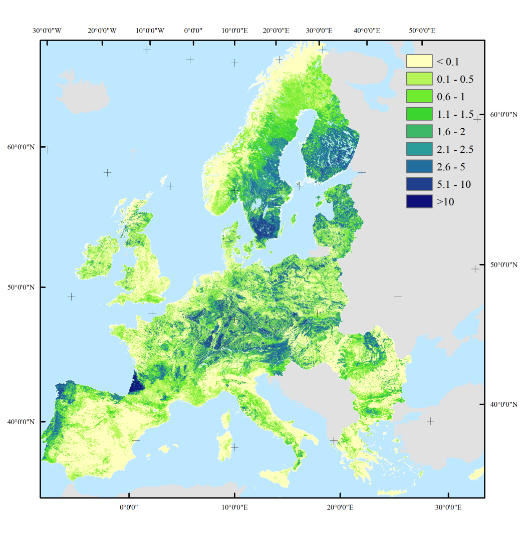
The European Forest Institute, in cooperation with Humboldt-Universität zu Berlin and VU University Amsterdam, developed a set of high-resolution wood production maps for European forests. The maps contain predicted volumes of wood production, based on statistics collected for 29 European countries from 2000 to 2010. The maps were created by disaggregating statistics from 460 administrative regions to 1×1 km² raster maps based on a set of location factors (including productivity, tree species composition and terrain ruggedness), which were identified through regression modelling. The maps were validated and verified using forest inventory plot data and detailed wood production statistics for various regions across Europe.
Please see the article for more information on underlying data and calculations.
The maps are available as GeoTIFF map images and can be downloaded here .
A poster showing the wood production map can be downloaded here.
References
When using the data, please include the following citations:
Verkerk, P.J., Levers, C., Kuemmerle, T., Lindner, M., Valbuena, R., Verburg, P.H., Zudin, S., 2015. Mapping wood production in European forests. Forest Ecology and Management 357, 228-238.
Verkerk PJ, Levers C, Kuemmerle T, Lindner M, Valbuena R, Verburg PH, Zudin S (2015) Data from: Mapping wood production in European forests. Dryad Digital Repository. http://dx.doi.org/10.5061/dryad.mk067