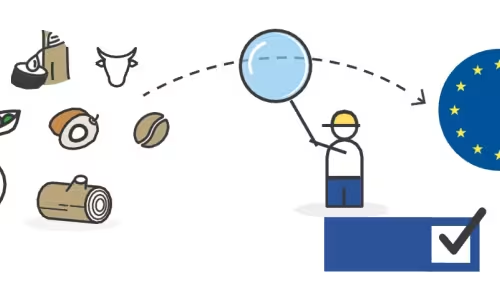
What free and/or open-source tools are available to supply chain actors for EUDR data management and supply chain sustainability?
Other language versions: Español
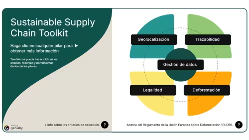
Collecting and analysing data for EU Deforestation Regulation (EUDR), Corporate Sustainability Due Diligence Directive (CSDDD), and other sustainability requirements can get complicated fast. For EUDR specifically, there are four types of data you need: traceability, geolocation, deforestation, and legality. But gathering this information usually means juggling several different tools. Figuring out which tools actually fit your organisation's needs and capacity is its own challenge.
This guide is here to help on both fronts. We'll walk you through what each pillar actually requires — in plain language, with no technical jargon — so you understand the process before you pick a tool. Then, for each pillar, we've pulled together a list of free and open-source tools and the context you need to identify which ones might be right for you. This guide is meant to complement other tool directories and reviews, with a focus on free and open source tools that may be best suited for many entities.
Think of this as your practical companion for EUDR compliance: combining clear guidance and useful tools to support you through every step of your due diligence and deforestation risk checks.
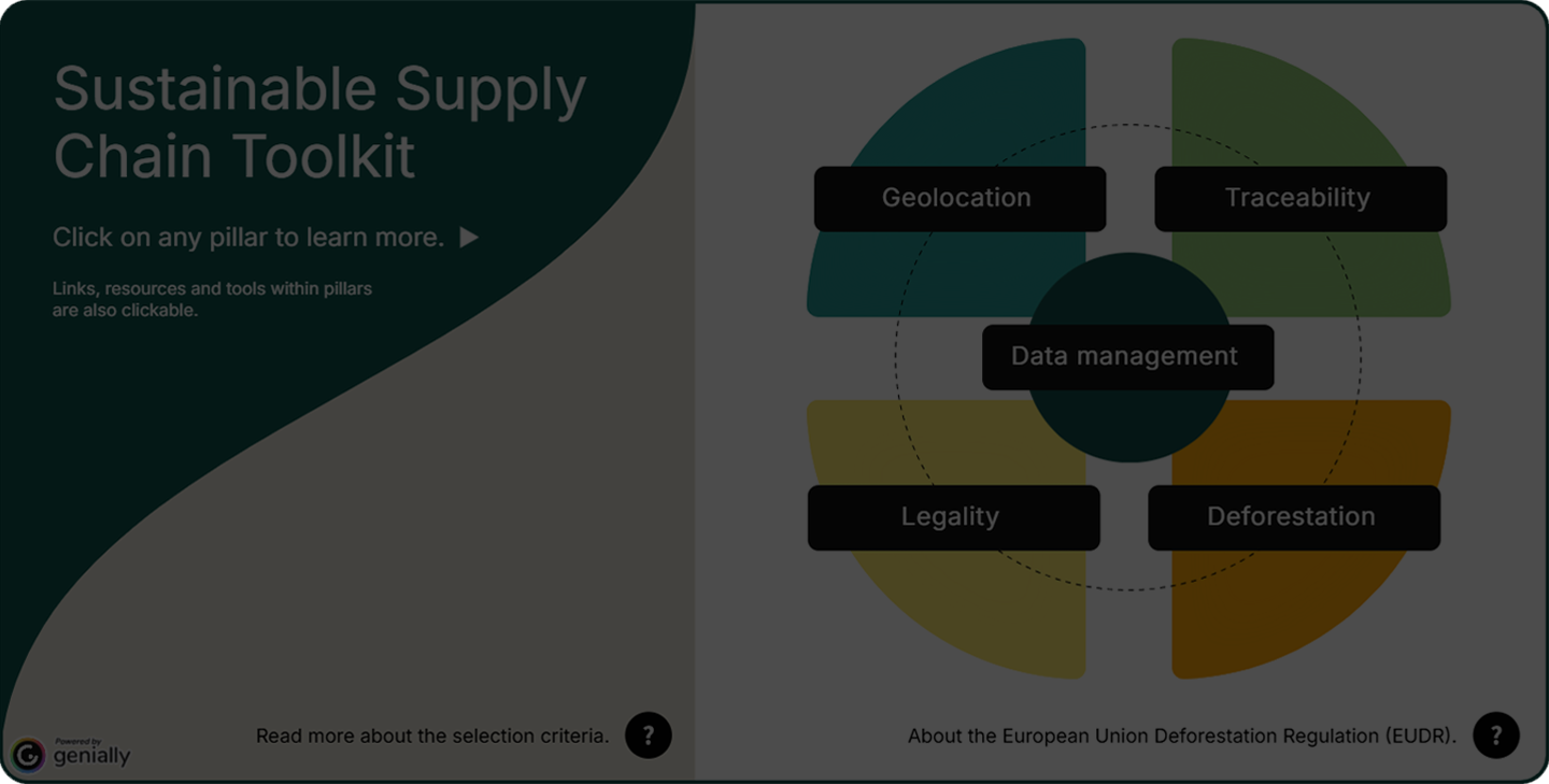
This element is interactive. To view it properly, you need to accept cookies.
Geolocation data
Ground
Missing geolocation data? Open Foris Ground is a open-source, map-first, free data collection platform that enables non-technical users to easily create surveys and collect georeferenced field data. It supports multiple question types including mapping points or polygons, collecting written or multiple choices responses, photos and more. Data can be collected offline using a mobile device and then syncs to the cloud when service is available. The platform features real-time progress tracking and data synchronization when users return to service, allowing for exports in CSV and GeoJSON formats.
What are its main functionalities?
Survey design
- Create and publish surveys
- Define sites, geospatial units and manage users and roles
Field data collection
- Collect data on mobile (even offline)
- Use maps and take photos
- Data saved safely on device
Data management
- Sync data when back online
- Track progress in real time
- Export data for analysis (CSV, GeoJSON)
Who are the intended users?
Ground empowers local actors and drives sustainability impact at scale, particularly for non-technical users with little to no special training. From smallholders and cooperatives, community organizations, exporters, aggregators, producers, producer organisations, data partners to government agencies.
How can users access the tool, and does it require an internet connection?
Survey design and management:
- Sign in using a Google account (no separate password required).
- Open the web console in a browser to design and manage surveys.
Data collection:
- Download the Android app from the app store and install it on a mobile device .
- Select an assigned survey or download through link / QR code in the mobile app to start field data collection.
- Use the app online or offline, with data syncing automatically when connectivity is restored. The Ground mobile app enables offline data collection in remote areas. Surveys and satellite background imagery must be downloaded prior to fieldwork.
Requires internet access periodically (e.g. to sync or update) but supports offline use in-between.
In which languages is the tool available?
English, French, Spanish, Vietnamese, Portuguese, Thailandese, and Lao.
Data storage and privacy
Ground is built within the Firebase ecosystem, with all data stored in Google Cloud Data Centers. For the Open Foris Ground instance, the database is hosted and maintained by the FAO.
Platform-managed cloud: Data is stored on the platform’s infrastructure.
On-device / local only: Data is stored and processed on the user's device (via the app) and is not transmitted to external servers under normal use.
Processed and retained in cloud: Data is stored in a Google Firebase environment on safe S3 cloud infrastructure. The firebase account is owned by FAO without access to the data, which are owned by the initial survey organizer. Data can be downloaded locally and deleted from the cloud.
The app is open source, so the user can elect to host a copy on their own server allowing them to store responses in their preferred location.
Code accessibility and pricing
Free (all services are free to use) and 100% open-source.
Integrations
Designed for easy integration with other systems, ensuring interoperability - making it ideal for Digital Public Infrastructures (DPIs). Ground can be one building block of a DPI that enables the production of robust, transparent, and replicable data.
Ground can call external APIs (like Open Foris WHISP) to automatically augment field data. Non-automated workflows have been developed with WHIMO as well.
Learning resources and useful links
Websites:
Manuals, downloads, Github repo, and other configuration resources:
- Ground manuals and guides
- Ground Frequently asked questions
- Github Ground Platform
- Github Ground Android App
- Github Contributing to Android Development
Video resources:
Developers
Co-developed by the Food and Agriculture Organization (FAO) and Google, under the AIM4Commodities programme.
GeoRoots
Your geolocation files need some work? GeoRoots can help you manage and edit your GeoJSON file while allowing you to view, check, and improve your data. Whether you need to clean coordinates, verify plot boundaries, or prepare files for compliance, GeoRoots is the perfect tool to work with your geospatial data.
What are its main functionalities?
GeoRoots is unique suite of tools that doesn't store any datasets, offering a free and open source solution for cleaning, deduplicating, validating and other data processing of geolocation data to ensure polygons are geometrically correct.
It consists of the following tools:
- GeoRoots Editor: validate and correct geometric errors like overlapping, gaps and rings in the dataset. Allows manual and auto validation.
- GeoRoots Prepper: Generate EUDR-compliant GeoJSON from spreadsheet data.
- GeoRoots KML: Convert KML files to GeoJSON.
- GeoRoots Mapper: Visualize and inspect EUDR DDS GeoJSON.
- GeoRoots Fixer: Read, edit, validate, and repair GeoJSON.
- GeoRoots Merger: Combine multiple GeoJSON files.
- GeoRoots Splitter: Filter, sort, and split GeoJSON.
- GeoRoots Deduplicator: Detect and remove duplicate GeoJSON features.
Who are the intended users?
Operators, importers, brands, retailers, exporters, aggregators, producers, producer organizations, data partners, Competent Authorities.
How can users access the tool, and does it require an internet connection?
- Open the tools directly in a web browser (no installation needed).
- Optionally download the tools to use them offline.
- Start using them immediately, no account or login required.
- Use them on any computer, even in low-connectivity or remote areas.
Users can download and use tools completely offline.
In which languages is the tool available?
English, French, Spanish, Mandarin, Swahili, and others.
Data storage and privacy
- All data is processed and stored locally in your browser (on your device)
- No data is sent to external servers at any point
- Full privacy is ensured, as your data never leaves your computer
Code accessibility and pricing
Free (all services are free to use) and 100% open-source.
Integrations
- Existing integration with Sylva.
- The code is in GitHub and can be added to other tools.
Learning resources and useful links
Websites:
Manuals, downloads, Github repo, and other configuration resources:
Video resources:
Developers
Developed as an open-source initiative in collaboration with Bailies Coffee Roasters and the European Forest Institute.
KoboToolbox
KoboToolbox is a free, open-source platform for building forms and collecting data, used widely across humanitarian, development, and research work. It supports a rich range of question types — including GPS points, areas and polygons, photos, barcodes, ranking and matrix questions, skip logic and calculations — which makes it well suited to complex compliance surveys. Data can be collected offline on a mobile device and synchronised to the server once connectivity returns. The platform handles multi-language forms, role-based team access, and exports to Excel, CSV, SPSS, and GeoJSON, and it can push each submission to downstream systems in real time through REST integrations.
What are its main functionalities?
Form design
- Build forms in a drag-and-drop editor or from an XLSForm spreadsheet
- Use advanced logic: skip patterns, constraints, calculations, and repeating groups
- Manage question libraries and reuse blocks across projects
Field data collection
- Collect data offline on Android (KoboCollect) or in any browser (Enketo web forms)
- Capture GPS points, polygons, photos, audio, video, and barcodes
- Collect on shared devices with multiple enumerators
Data management
- Monitor incoming submissions with tables, maps, and summary reports
- Edit, validate, and clean records and manage submission status
- Export to Excel, CSV, SPSS, and GeoJSON, or connect to BI and analysis tools
Who are the intended users?
Exporters, aggregators, producers, cooperatives, NGOs, research teams, government agencies, and humanitarian organisations.
How can users access the tool, and does it require an internet connection?
Form design and management
- Sign up for a free account on a KoboToolbox public server, or use a self-hosted instance
- Build and manage forms in the web-based Formbuilder (no installation required)
Data collection
- Install the free KoboCollect app from the Google Play Store on an Android device, or open the form link in any browser via Enketo
- Assign or share a form by link or QR code to begin collecting
- Collect online or offline; submissions stored on the device sync automatically when connectivity is restored, which suits remote fieldwork
Requires internet access periodically (to download forms and upload submissions) but fully supports offline collection in between.
In which languages is the tool available?
The interface is community-translated into more than 30 languages, and forms themselves can be authored in any number of languages — including right-to-left scripts — with enumerators switching language on the device.
Data storage and privacy
Public servers: KoboToolbox runs two public servers with identical features — a Global Server (hosted in the United States) and an EU Server (hosted in Ireland) for organisations with European data-residency requirements. Both run on Amazon Web Services. COSA, in partnership with the Gates Foundation, configured free, open-source integrations between Baserow, Kobo and WHISP.
Security: Database content is encrypted at rest, data in transit is protected with SHA-256 / RSA encryption, and users can optionally enable data-level encryption using their own private key. The platform is GDPR-compliant and offers data processing agreements for EU-based users.
Self-hosted: Organisations can host their own KoboToolbox instance for full control over where data resides and how it is managed. COSA, has published a simple guide on how to self-host using Pikapods.
Code accessibility and pricing
Free and open-source (released under the AGPL). The Community plan is free — 5,000 submissions per month and 1 GB file storage, with unlimited forms, collaborators, and data collectors — and paid Professional, Teams, and Enterprise plans plus add-ons raise these limits. Self-hosting carries no licence cost.
Integrations
KoboToolbox exposes a full REST API and supports REST Services (webhooks) that forward each submission to an external endpoint in real time. It also connects to Excel, Google Sheets, Power BI, and ArcGIS, among others.
Learning resources and useful links
Websites:
Manuals, downloads, and support resources:
- KoboToolbox documentation and Help Center
- KoboToolbox Community Forum
- KoboToolbox Source code on GitHub
Video resources:
Developers
KoboToolbox is developed and maintained by KoboToolbox, a non-profit initiative originally created at the Harvard Humanitarian Initiative, with support from a range of humanitarian and development partners.

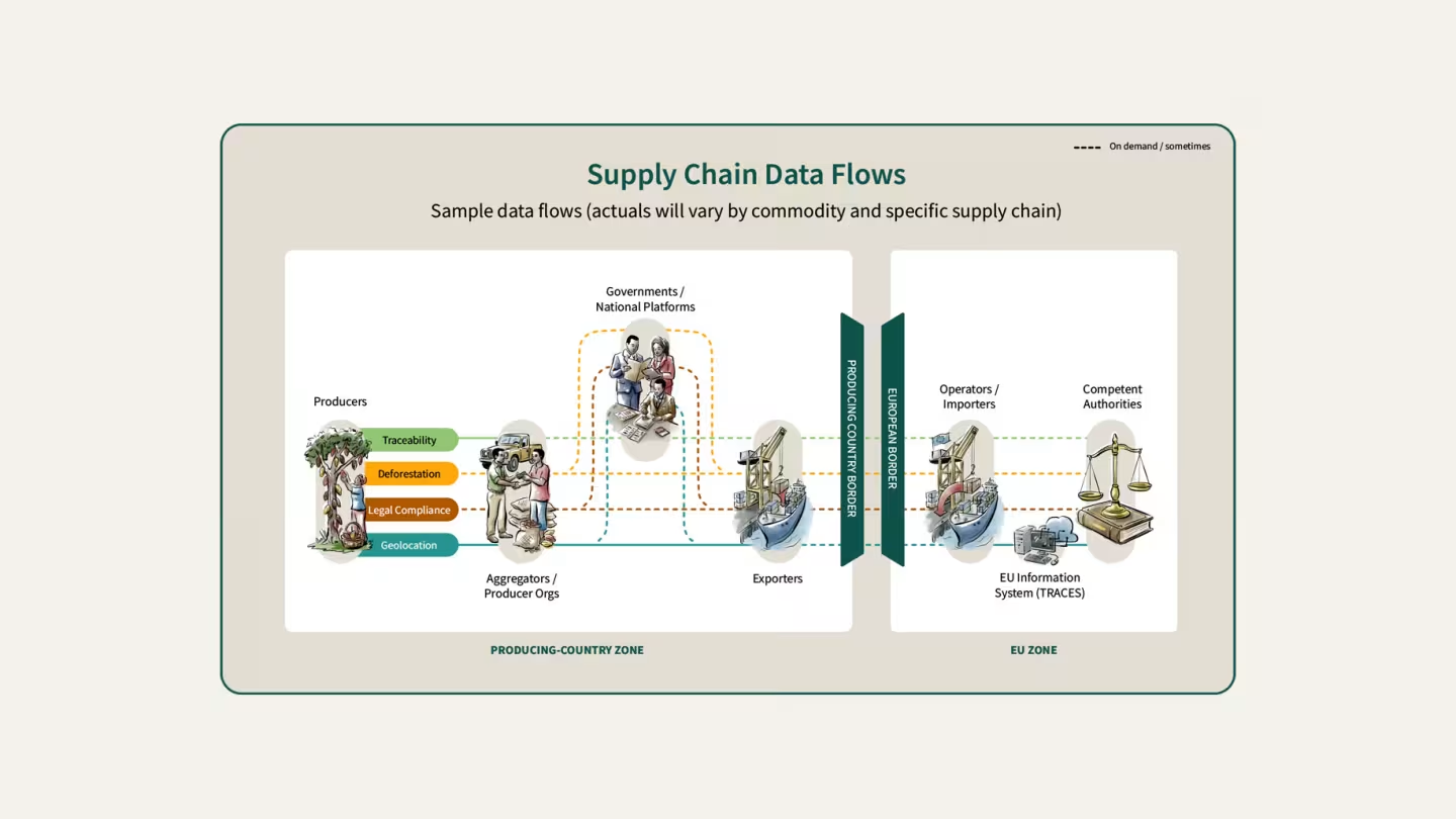
Each transaction is an opportunity to pass origin information forward, helping maintain traceability as commodities change hands.
Traceability
Commodity Converter
Ever wondered how much raw material is behind a processed product? Commodity Converter helps you understand the link between processed goods, the raw materials used to make them, and the hectares needed to produce them. It is a useful tool for checking whether supply chain information makes sense and identifying possible inconsistencies.
What are its main functionalities?
- Converts processed product quantities into raw commodity equivalents.
- Estimates area required based on specific yield data.
- Displays the processing steps linking products to raw commodities.
- Allows downloading summaries for verification.
Who are the intended users?
Importers, traders, and processors, competent authorities, NGOs, certification bodies and auditors.
How can users access the tool, and does it require an internet connection?
Users can access it directly through a web browser no login or installation required.
The tool is not functional offline, it requires internet connection.
In which languages is the tool available?
English.
Data storage and privacy
N/A
Code accessibility and pricing
Free (all services are free to use).
Integrations
No integrations to date.
Learning resources and useful links
Developers
European Forest Institute (EFI).
INATrace
Build traceability from farm to final buyer. INAtrace provides the backbone of an internal traceability system, helping organizations record and manage product flows throughout the supply chain. From raw material sourcing to export and delivery to EU buyers, it creates a structured digital record that strengthens transparency, supports due diligence, and enables better supply chain management.
What are its main functionalities?
INATrace Web App
- Used to manage and view supply chain and traceability data
- Stores information on products, actors, prices, and processing steps
- Allows data sharing across the supply chain and with consumers via QR codes
- Supports monitoring and EUDR compliance processes
INATrace Mobile App
- Used directly in the field, even offline
- Creates farmer profiles and maps farm polygons
- Collects field data and syncs it automatically to the web platform
- Enables initial deforestation checks through the FAO WHISP integration
The INATrace mobile app collects farmer and field data offline, while the web app stores and manages it for traceability and EUDR compliance. All data is automatically synchronized between both platforms.
Who are the intended users?
Farmers organisations, supply chain actors and buyers.
How can users access the tool, and does it require an internet connection?
Web platform: Go to the official INATrace registration page, fill out your name, work email, and password, and click Register.
Mobile app (for field data):
- Download from Apple App Store or Google Play Store.
- You can use the app in two ways:
- Log in: Enter the exact same email and password you created on the web.
- Guest mode: Use the app without an account to map new farm plots using GPS, collect on-site data, and download offline maps.
The app allows data collection offline, including farmer profiles and GPS data, with automatic synchronization once an internet connection is available.
In which languages is the tool available?
English, Spanish, German, Kinyarwanda.
Data storage and privacy
Data is stored securely in the cloud (with temporary local caching on the mobile app for offline use) and backed up automatically to prevent loss.
The user retains ownership of their data and controls what remains private or is shared publicly for regulatory compliance.
Code accessibility and pricing
Free (all services are free to use) and 100% open-source.
Integrations
Existing integration with WHISP.
Learning resources and useful links
Websites:
Manuals, downloads, Github repo, and other configuration resources:
- INATrace admin guide
- INATrace technical guide
- INATrace mapping guide
- INATrace user guide for buyer companies (English)
- INATrace user guide for exporters ( English and Spanish)
- INATrace user guide for producers ( English, Spanish and Kinyarwanda)
- INATrace pricing guide
- INATrace wiki
- FAQs (English and Spanish)
- INATrace GitHub
- INATrace Android app
Video resources:
Developers
Financed by the German Federal Ministry for Economic Cooperation and Development, implemented by GIZ under the Sustainable Agricultural Supply Chains Initiative (SASI).
WHIMO
Complex supply chains need simple solutions. WHIMO helps organise information on suppliers, products, and transactions in one place. Designed as an intuitive open-source mobile application, it makes it easier to follow products from their origin to their destination while remaining flexible enough to adapt to your own processes.
What are its main functionalities?
WHIMO provides a simple traceability solution which is ready to use out of the box. It is best for entities that need a straightforward traceability solution for first mile or downstream traceability, don't have the capacity or desire to configure a more complex solution, and do not need to have digital records for complex segregation (e.g. segregating certified or EUDR compliant volumes from non-certified/compliant volumes)
- Record farm geodata (QR scan, GPS, map pin, or manual entry).
- Capture and manage transactions (buy/sell, volumes, product transformations).
- Track commodities and processed products through the supply chain.
- View transaction history and traceability performance.
- Identify and request missing geolocation data from suppliers.
- Visualize full supply chains (direct and indirect suppliers).
- Collect data from suppliers and share it with customers.
- Transfer traceability data across the supply chain.
- Download supply chain data for due diligence reporting.
Who are the intended users?
Cooperatives, local aggregators, transporters, processors, exporters, and EU Operators as well as producing-country governments.
How can users access the tool, and does it require an internet connection?
- Download the mobile app on iOS or Android (“download and go”).
- Create an account to access the system.
- Use the online web portal to view and manage data.
- Organizations can also deploy their own version using open-source code (GitHub) and fully customize the system.
The mobile apps have “offline-first” functionality.
In which languages is the tool available?
English, French and Spanish.
Data storage and privacy
Data is stored and managed by EFI according to its data policy.
Code accessibility and pricing
Free (all services are free to use) and 100% open-source.
Integrations
Current integration with OpenForis Ground via a simple QR code workflow. Integrations with WHISP, Sylva and INATrace coming soon.
Learning resources and useful links
Websites:
Manuals, downloads, Github repo, and other configuration resources:
Video resources:
Developers
EFI, Mad Devs, with funding from the Agence Francaise de Développement (AFD) and the European Union under the Technical Facility on Deforestation-Free Value Chains.
TraceFoodChain
Follow your product's journey from start to finish. TraceFoodChain helps you record and visualise every step of your supply chain, from producers to traders, processors, exporters, and buyers. By connecting all the actors involved, it helps build a clear picture of where products come from and how they move through the supply chain.
What are its main functionalities?
- Create farms, suppliers, products, and production batches, then attach documents or compliance info.
- Follow products through the supply chain and view their full history and movement.
- Generate QR codes, share records with buyers/auditors, and export compliance reports for verification.
Who are the intended users?
Farmers and cooperatives, exporters & processors, importers and buyers (retailers/brands), regulators / NGOs.
How can users access the tool, and does it require an internet connection?
- Sign up or receive an invitation.
- Verify your email address.
- Join an organization/workspace with assigned roles.
- Access dashboard to add supply-chain data.
- Generate/share QR codes or compliance reports.
Requires internet access periodically (e.g. to sync or update) but supports offline use in between.
In which languages is the tool available?
English, Spanish, German and French.
Data storage and privacy
Information unavailable.
Code accessibility and pricing
Free (all services are free to use) and 100% open-source.
Integrations
Information unavailable.
Learning resources and useful links
Websites:
Manuals, downloads, Github repo, and other configuration resources:
Developers
TraceFoodChain is developed by Permarobotics and donated to the AgStack Foundation (Linux Foundation), with ongoing contributions from an open-source community of agri-tech and research partners.
It is also used and evolved within the DIASCA ecosystem, where multiple institutions collaborate on deployment and interoperability.

Deforestation risk analysis
WHISP
See the deforestation risk behind your plots in just a few clicks. By comparing your plot centre point or boundaries with the best publicly available forest and land-use maps, Open Foris WHISP helps you quickly identify potential deforestation risks. Free, open-source, and highly visual, it turns complex geospatial analysis into results that anyone can understand.
What are its main functionalities?
- Assess plots of land for deforestation risk using multiple public forest and land-use datasets. There are multiple datasets for each category: full current list of datasets used in WHISP.
- Support EUDR and due diligence compliance by generating analysis of deforestation-free status.
- Analyze plots at scale from a single farm to thousands of polygons in bulk.
- Visualize and report results through maps, dashboards, and downloadable assessments.
- Integrate into traceability and monitoring workflows via web tools, API, GIS platforms, and mobile data collection.
Who are the intended users?
WHISP is for everyone along the commodity supply chain, from smallholders, cooperatives, third parties, and operators, to governments and relevant authorities.
How can users access the tool, and does it require an internet connection?
- Access WHISP through the official Open Foris WHISP web app or the WHISP webpage. Create an account and log in to upload plot points or boundaries and run analyses. WHISP accepts polygons and points geometries. Input data must be provided in GeoJSON, WKT or GeoID format.
- Available as WHISP Earth Map for individual plot visual interpretation, for in detail assessment of single plots.
- Available WHISP API for programmatic access with API key and for integration in other systems.
- The WHISP source code is written in Python and can be executed as Jupyter Notebooks for large datasets. The notebooks provide added flexibility to run tailored analyses and modify input data layers. Access and analyse various public geodata layers.
- The WHISP QGIS plugin streamlines deforestation risk analysis, for GIS analysts and desktop workflows, by enabling users to submit their selected geometries directly from QGIS to the Open Foris WHISP API.
- WHISP outputs can be analysed and visualised in dashboard templates to allow users to quickly summarise and query risks, assess specific criteria, and view their plots in WHISP Map. Access the dashboard templates on the Forest Data Partnership’s GitHub.
Not designed for full offline use. It relies on cloud-based Earth Observation datasets and APIs, so the main analysis and mapping functions require an internet connection.
In which languages is the tool available?
English.
Data storage and privacy
Data passes through cloud infrastructure for processing but is not persistently stored there. WHISP follows FAO's principles for responsible data management, transparency, and privacy.
Code accessibility and pricing
The tool is coded entirely open source but completely relies on processing through Google Earth Engine, which is a Proprietary Google service.
Using the API is completely free. Large-scale users may find the amounts of geometries processable at a time insufficient and are encouraged to use WHISP Jupyter Notebooks and run on their own Google Earth Engine accounts.
Integrations
Whisp API is called from Open Foris Ground, TechnoServe's Terra Trac, Trace Food Chain, and commercial solution providers. Non-automated workflows have been developed with WHIMO as well.
Sylva (ITC) is using Whisp for the deforestation status analysis.
Learning resources and useful links
Websites:
Manuals, downloads, Github repo, and other configuration resources:
- WHISP manual
- WHISP API
- WHISP QGIS Plugin
- WHISP Jupyter Notebook
- Layers description
- WHISP Frequently Asked Questions
Video resources:
Developers
FAO and the Forest Data Partnership (FDaP) under the AIM4Commodities programme.
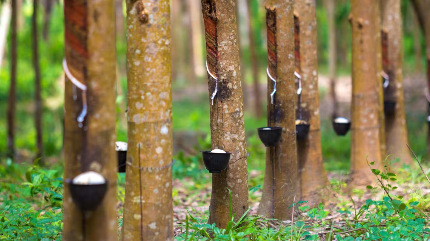
Collecting latex from rubber trees.
Photo by:
Freepik/jcomp
Legality risk analysis
Legality Due Diligence Navigator
Turn legal complexity into a practical roadmap. The Legality Due Diligence Navigator provides a methodology for governments, companies, civil society and other value chain actors to build a common understanding of the legislation relevant to EUDR compliance, the associated compliance risks, and the information and evidence needed to assess and monitor those risks.
What are its main functionalities?
- Step 1: Map legal requirements: Identify and structure all relevant national laws and regulations into a legal requirements matrix for the commodity.
- Step 2: Build due diligence guidance: Translate legal requirements into practical checks, risk assessments, and mitigation actions to support compliance.
- Step 3 (optional): guidance on how to pilot the tool in real conditions, then refine and update the legal mappings and due diligence recommendations based on feedback.
Who are the intended users?
While all value chain actors may use the legality due diligence tools, the methodology itself is intended to be used by a multi-stakeholder group including government entities, private companies and civil society representatives.
How can users access the tool, and does it require an internet connection?
Those who wish to use the methodology including multi-stakeholder group including the governments, local legal experts, and public and private actors familiar, should contact EFI to discuss their interest and intent.
Those wishing to read the results of reports that have been completed and find them on the Legality Due Diligence Navigator website.
In which languages is the tool available?
English, French, Spanish.
Data storage and privacy
The Legality Due Diligence Navigator website hosts the tools developed using the methodology and which were supported by EFI.
Code accessibility and pricing
Free (all services are free to use).
Integrations
Integration with Sylva is currently being explored.
Learning resources
Developers
European Forest Institute (EFI) in cooperation with Preferred by Nature.

Data management
Deforestation Free Trade Gateway (DFTG) / Sylva
Sylva (DFTG) brings existing data, tools and services into a guided workflow. It supports due diligence processes but does not determine compliance or replace the judgement and responsibilities of producers, exporters, operators or other users.
What are its main functionalities?
- Sylva (DFTG) can ingest data in a number of formats and file-types and collate them into a single database, clean
- Supports the mapping, editing, cleaning and validation of geolocation data, including through GeoRoots
- Conducts deforestation-risk analysis using FAO’s WHISP service, with results displayed in the platform.
- Enables users to evaluate and document deforestation and degradation risks as mandated by the regulation.
- Connects compliant producers with EU buyers, helping smallholders meet legal standards through a standardized, secure process.
- Enables users to export selected information in formats such as Excel and GeoJSON.
- Supports the preparation of information for use in external systems, including the EU Information System.
Who are the intended users?
Sylva (DFTG) is intended for actors across agricultural value chains, including producers, cooperatives, exporters, processors, EU operators and traders, business support organisations, public institutions and development partners.
How can users access the tool, and does it require an internet connection?
To access Sylva (DFTG):
- Use the platform without an account to explore selected tools and guidance.
- Create an account to access additional functionalities, save information, manage datasets and share data with selected partners.
- Import existing producer, supplier and plot data in formats such as Excel, CSV, KML or GeoJSON.
- Review, map and edit geolocation data, including plot boundaries and GPS points.
- Run geolocation validation and deforestation-risk analyses using connected tools such as GeoRoots and FAO WHISP.
- Complete guided due diligence and legality-related steps, and export selected information for use in other systems..
The platform itself requires an internet connection. However, it is designed to support offline data collection through its partner applications.
In which languages is the tool available?
English, French, Spanish, Portuguese, German and Indonesian.
Data storage and privacy
Sylva (DFTG) is hosted within an ITC-managed United Nations environment. Users and dataset owners retain control over their information and can determine whether datasets are private, shared with selected organisations, available upon request or made more widely visible. Information is not automatically shared with buyers, authorities or other platform users.
Code accessibility and pricing
Free (all services are free to use) but proprietary (not open-source).
Integrations
Analysis of Geolocations using Whisp is automatic and viewable within the system. Global Forest Watch and Joint Research Centre datasets: additional map layers supporting the review of geolocation and forest-related information.
Data cleaning and validation via GeoRoots can be executed directly through the chat interface
Learning resources and useful links
Website:
Manuals, downloads, Github repo, and other configuration resources:
Developers
International Trade Center (ITC).
Baserow
Baserow is a free, open-source no-code database platform — an open alternative to tools like Airtable — that lets non-technical users organise data in familiar spreadsheet-style tables backed by a real relational (Postgres) database. Tables support linked records, formulas, roll-ups, many field types, and multiple views (grid, gallery, kanban, calendar, and form). It exposes a full REST API and webhooks out of the box, so it works equally well as a human-facing control panel and as the backend of an automated data pipeline. Baserow can run on its managed cloud or be self-hosted on your own infrastructure, and it exports to CSV, Excel, and other formats.
What are its main functionalities?
Data structuring
- Create databases and tables with linked records and a wide range of field types
- Add formulas, lookups, and roll-ups across related tables
- Organise records with grid, gallery, kanban, calendar, and form views
Collaboration and access
- Invite collaborators and set workspace roles and permissions
- Filter, sort, group, and share views with teammates or externally
- Use it as a lightweight control panel for operational data
Automation and integration
- Read and write data through a full REST API
- Trigger webhooks on row changes to drive external workflows
- Build no-code automations, or orchestrate with tools such as n8n
Who are the intended users?
Exporters, aggregators, producers, cooperatives, data partners, project teams, and government agencies needing a shared, structured data store.
How can users access the tool, and does it require an internet connection?
Setup and administration
- Sign up on Baserow’s cloud (baserow.io), or self-host an instance via Docker
- Work entirely in the browser — no desktop app to install
Everyday use
- Open the workspace in any browser to create tables, enter data, and manage views
- Connect other systems through the API and webhooks
Baserow is a web application, so it needs a connection to its server — whether Baserow’s cloud or your own self-hosted instance. It is not designed for offline use; in a field workflow it typically sits behind an offline-capable collection tool such as KoboToolbox, receiving data once it syncs.
In which languages is the tool available?
The interface is available in multiple languages — including English, French, German, Spanish, Italian, Dutch, Portuguese, Polish, and Chinese — with further community translations, and data can be entered in any language.
Data storage and privacy
Managed cloud: Baserow’s cloud stores data on EU-based infrastructure (Amsterdam). The platform states GDPR, HIPAA, and SOC 2 compliance.
Self-hosted: Running your own Baserow instance gives full control over where data is stored and who can reach it and provides unlimited rows and storage bounded only by the server’s disk. COSA, has published a simple guide on how to self-host Baserow using Pikapods.
Open access: Because the platform is open-source, an organisation can host and back up its own copy and hand the whole instance over to a beneficiary.
Code accessibility and pricing
Baserow’s core is free and 100% open-source: is released under the MIT license, with premium and enterprise features available in a separate directories in the same repository that is source-available and governed by Baserow's own proprietary premium/enterprise license. Baserow’s managed cloud offers a free tier (3,000 rows / 2 GB), unlimited rows and storage when self-hosted for free, and also offers paid Premium, Advanced, and Enterprise plans that offer additional SSO/SAML, row-level permissions, extra export/branding options, etc.
Integrations
Baserow provides a full REST API and webhook support, and integrates with automation platforms such as n8n, Zapier, and Make. See COSA guide and open-source n8n integration.
Learning resources and useful links
Websites:
Manuals, downloads, and source code:
Video resources:
Developers
Baserow is developed by Baserow, a company based in Amsterdam, the Netherlands, founded by Bram Wiepjes, with contributions from an open-source community.
Related content
Technical facility on deforestation-free value chains
We collaborate with commodity-producing countries to assist in transitioning to legal and deforestation-free value chains.
- Sustainable economy

¿Qué herramientas existen para cumplir con el EUDR?
Descubra qué herramientas gratuitas y de código abierto están disponibles para los actores de la cadena de suministro ante el EUDR.
- Sustainable economy
Unpacking legality requirements under the EU Deforestation Regulation
This factsheet explains the EUDR legality requirements and how operators can assess and demonstrate compliance with relevant legislation.
- Sustainable economy