Geolocation under the EUDR: from compliance requirement to supply‑chain opportunity
A new Insight developed by EFI’s Technical Facility on deforestation-free value chains explains how precise plot coordinates, submitted with the EU Due Diligence Statement, become the backbone of deforestation‑free, legally produced supply chains, and a catalyst for digitalisation and smallholder inclusion.
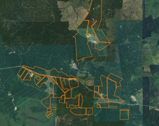
The EU Deforestation Regulation (EUDR) sets a clear benchmark: commodities entering or leaving the EU must be deforestation‑free and legally produced. From its entry into force, operators must implement due diligence covering information collection, risk assessment, and risk mitigation, placing geolocation at the heart of compliance. Geolocation pinpoints where a commodity was grown and enables operators to verify deforestation‑free status and legal compliance. Without geolocation, products cannot be placed on the EU market.
Accurate geolocation underpins three critical checks: deforestation risk, legal compliance risk, and mixing risk in complex supply chains. Collecting geolocation data is feasible with tools such as FAO Ground, TerraTrac, INATrace, KoboCollect, QField, and GeoRoots.eu. Emerging standards such as the GeoID also help assign anonymous, consistent identifiers to plot polygons across systems.
Real‑world programmes show what’s possible: Uganda mapping nearly one million coffee farmers; Malaysia strengthening GeoPalm; Colombia’s SICA registry; Tanzania’s Coffee Board pilot. Common pitfalls—such as outlier points or incorrect formats—can be mitigated through SOPs, training, automated QA checks, and centralised data management. Critically, operators must retain geolocation and due‑diligence records for at least five years.
Geolocation is more than just a regulatory checkbox. When done correctly, it enhances market position, supports the formalisation of smallholders, and drives sector-wide digitalisation and data standards.
- Download the Insight: Geolocation and the EU Deforestation Regulation (EUDR)
- More information: Technical Facility on deforestation-free value chains