GeoRoots Editor: Accessible, secure and EUDR ready geodata editing directly in your browser

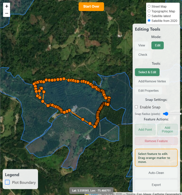
A new open‑source tool developed within the GeoRoots family and in collaboration with the European Forest Institute makes it easier than ever for companies to prepare high‑quality geolocation data for EUDR due diligence. GeoRoots Editor provides a streamlined, privacy‑first interface that enables users to create, clean, verify and export plot coordinates in full GeoJSON compatibility.
Under the EU Deforestation Regulation (EUDR), operators must submit precise geolocation of production plots as part of the EU Due Diligence Statement, making accurate geodata central to proving deforestation‑free and legally compliant production. GeoRoots Editor was purpose‑built for this task, allowing users to:
Create and adjust geolocation points or polygons directly in the browser.
Validate geometry and spot common errors such as outliers, self‑intersections or invalid formats.
Export data in clean GeoJSON format, fully aligned with EUDR requirements.
The tool’s privacy‑first architecture guarantees data security: all processing happens on the user’s device, ensuring sensitive geolocation information never leaves their computer.
By reducing the need for dedicated GIS software and enabling rapid onboarding, GeoRoots Editor helps organisations cut compliance costs and raise data quality. As a fully open‑source tool, it also supports wider sector innovation and collaboration.
More information: