MySustainableForest platform: improving forestry through Earth observation solutions

Forests cover more than a third of Europe’s total land area (215 million hectares). Forestry makes a significant contribution to the EU economy, employing three million people in the sector; it already accounts for 1% of the global GDP on an upward trend. This context illustrates the growing importance of the forestry sector, thanks in part to new bioeconomy efforts and the green agendas of Western countries.
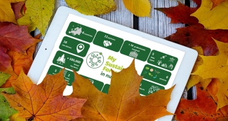
In the last three years, the European project MySustainableForest emerged as an initiative to help modernise the forest-based sector and place it at the forefront of digitalisation. Through the development of a virtual platform and a portfolio of services based on remote sensing technology, MySustainableForest provides accurate and up-to-date information to support sustainable and efficient forest management decision-making throughout the entire wood production cycle, from planning to sylvicultural plans, industrial operations or ecosystem services.
One of the main advantages of MySustainableForest is the offer of a wealth of integrated Earth Observation data and technologies to promote improved and more sustainable forest management. Through data provided by Copernicus Sentinel and Landsat satellites, LIDAR solutions, socio-economic and wood quality models, the platform offers a portfolio of 21 geoinformation products (see portfolio here) to forest stakeholders. These products enable users to evaluate biomass volume, produce wood quality maps and develop an early strategy to deal with the urgent effects of forest health decay caused by droughts and pests, in some locations exacerbated by climate change, among many other benefits.
MySustainableForest has analysed the needs of many end users in the forestry sectors. These needs were matched and integrated with earth observation technologies solutions that can facilitate specific activities of the forestry cycle and, ultimately, to add value to the products in the wood market. The following milestones have been achieved:
- Develop a one-stop MySustainableForest platform, where the users can request a variety of products; these products can be processed and then, the user can visualise, do analytics and download the results on portable devices, if needed.
- Support forest managers with site-based geo-information products derived from satellite, LiDAR, meteorological and sonic in-situ wood fiber data, along with customed forestry models.
- Provide forest thematic products in an easily accessible way through a digital platform that can be integrated within the user’s day-to-day tools due to the standardised metadata and formats.
- Demonstrate the quality, ease of use, regular availability and cost-effectiveness of the products across the entire community of forest managers, industry, and owners in Europe.
The European consortium behind these developments is formed by 11 entities from six European countries, led by the Spanish technology multinational GMV and its United Kingdom subsidiary. These organisations and enterprises are the European Forest Institute (EFI) in Finland, RAIZ Research Centre (Instituto de Investigaçao da Floresta e Papel) in Portugal, the Croatian Forestry Research Institute CFRI (Hrvatski Sumarski Institut), the Mendel Forest University UFE (Mendelova Univerzita V Brne) in the Czech Republic, the Navarre Forestry Association FORESNA in Spain, the Lithuanian Forest Owners Association FOAL (Lietuvos Misko Savininku Asociacija), National Centre of Forest Owners CNPF (Centre National de la Propriete Forestiere) in France, and the Spanish SMEs Madera+ and Föra Forest Technologies.
Innovations achieved through MySustainableForest are aligned with the objectives of the EU Forest Policy, the EU Innovation Policy and the EU Space Policy and its flagship Earth observation programme, Copernicus. The project was funded by the Horizon 2020 programme, the European Union’s Framework Programme for Research and Innovation, which supports R&D projects in different performance areas.


