The Forest Carbon Monitoring project: Tools and insights to combat climate change
Discover how innovative satellite and field-based tools are helping decision-makers protect forests and mitigate climate change, and hear from real users putting them into practice.
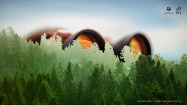
Forests are powerful allies against climate change. They absorb carbon, protect biodiversity, and provide countless benefits for people and the planet. But to keep forests healthy, we need to know what’s happening on the ground, and in the canopy! That’s where forest carbon monitoring comes in.
The Forest Carbon Monitoring (FCM) project, funded by the European Space Agency, combines satellite imagery with on-the-ground data to track forest biomass and carbon levels more accurately and affordably. Our tools work at multiple scales, from local demonstration areas to continental overviews. They are designed for forest owners, managers, policy makers, carbon traders, and international organizations who need reliable information to guide climate action.
The FCM project is coordinated by Jukka Miettinen from VTT. Within FCM CCN2 (the second phase of the project), the European Forest Institute (EFI) leads WP4000 (Outreach) and contributes to user interaction across the project. EFI is responsible for maintaining and updating the FCM website and blog; producing promotional materials (brochure, autoplay slide-sets, video); organizing the open user workshop (planned in the context of the Living Planet Symposium 2025). The project phase 2 is staffed with Rosa Castañeda, Gesche Schifferdecker and Jo Van Brusselen (lead of EFI’s contributions), while Yasmin Maximo was also involved in the user interaction in phase 1 of the project.
This video introduces the FCM project, showing the tools we offer and how they can help make informed decisions about forest carbon stocks.
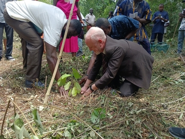
In the next video, we hear from users in Catalonia, Spain, and the Colombian Amazon. Basanta Gautam from South Pole explains how field data strengthens satellite monitoring, while Teresa Baiges from the Centre of Forest Ownership in Catalunya highlights the value of regularly updated satellite data. Their insights show how combining technology with local knowledge creates robust, adaptable systems for sustainable forest management and reliable carbon financing.
Stay updated! For the latest project news, tools, and stories from the field, visit forestcarbonplatform.org